Excavations in 2025
Introduction
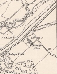
The line of the Antonine Wall passes through the property at 49 Seabegs Road, as shown in the map extract from the World Heritage Site document. This shows that the Ditch lies under the southern side of the house with the upcast material from it thrown up into what is now the front garden and the main road. This line was taken from the first editions of the Ordnance Survey maps which were surveyed before the present houses were built in the two decades before the Second World War, and when the earthwork was still visible.
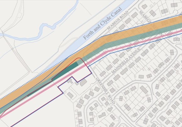
The line was verified by excavation to the west in 2003 under Seabegs Road (Bailey 2021, 511); and to the east at Mannfield Avenue in 2013 (ibid, 506-510). A change in alignment is depicted a little to the east of 49 Seabegs Road which corresponds with the highest ground in the vicinity thus agreeing with Poulter’s concept of the original survey for its building (Poulter 2009).
s
Excavation
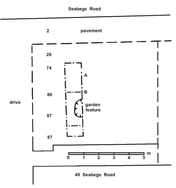
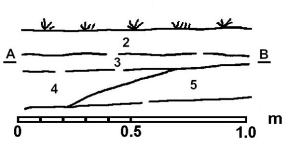
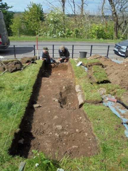
On 7 May 2025 a N/S 1.0m wide trench was hand excavated across the lawn of 49 Seabegs Road in Bonnybridge in the area of the upcast mound of the Antonine Wall. The lawn lies 0.85m above the level of the pavement to Seabegs Road, with a sunken border between the two. The “natural” or geological deposit was found to consist of orange/yellow sand containing rounded stones and iron-panning. This occurred at the northern end of the trench level with the sunken border and was located in the southern end of the trench in a sondage at the same level. Above this, in the bulk of the trench, was a dark blue-grey clay, also containing some stone (Layer 5 in the section). At the southern end of the trench F5 was 0.6m thick. At the northern end it petered out 5.5m north of the house. This northern tail was covered by light brown grit and gravel (F4) whose northern extent is unknown as it was truncated by the sunken border and the road. It presumably represents material dug from a greater depth in the Ditch and similar gravel spreads were noted at Arnothill and Callendar Park (Bailey 2021, 494-497; Bailey 1995).
Above F4 was a thin spread of dark orange sand which had been used to level up the north side of the garden prior to the depositing of a thin topsoil. F4 appears to have been derived from the natural in the area of the sunken border.
Discussion
The vestigial remnants of the upcast mound were found. Its northern side was truncated by the modern road and a garden bed. Its southern side is now cut by the house. The top of the mound was cut away as levelling of the area and for the garden, and a large flower bed was inserted. The initial levelling was probably carried out when the Forth and Clyde Canal was constructed in order to provide material for the terracing of Seabegs Road, whose predecessor lay well to the south (see Bailey 2021, 506-510). This created the steep slope down from the road to the canal.
Acknowledgements
The author would like to thank Richard Gillanders and Ian McAdam for their help with the digging and Mary Callow for her hospitality.
Bibliography
| Bailey, G.B. | 1995 | ‘The Antonine Frontier in Callendar Park, Falkirk: its form and structural sequence,’ Proc Soc Antiq Scot, 125 (1995), 577-600. |
| Bailey, G.B. | 2021 | The Antonine Wall in Falkirk District. |
| Poulter, J. | 2009 | Surveying Roman Military Landscapes across Northern Britain: The planning of Roman Dere Street, Hadrian’s Wall and the Vallum, and the Antonine Wall in Scotland. |
