In 1864 Colonel Dundas of Carronhall organised the excavation of a large mound situated at 380ft OD (116m) near the summit of Torwood. The hill provides excellent views in all directions, except the south (though with a small elevation this too provides long sight lines) and it was thought that the mound might be for burials. Instead a well-built stone dwelling of Iron Age date was discovered – one of the best preserved of the Lowland brochs
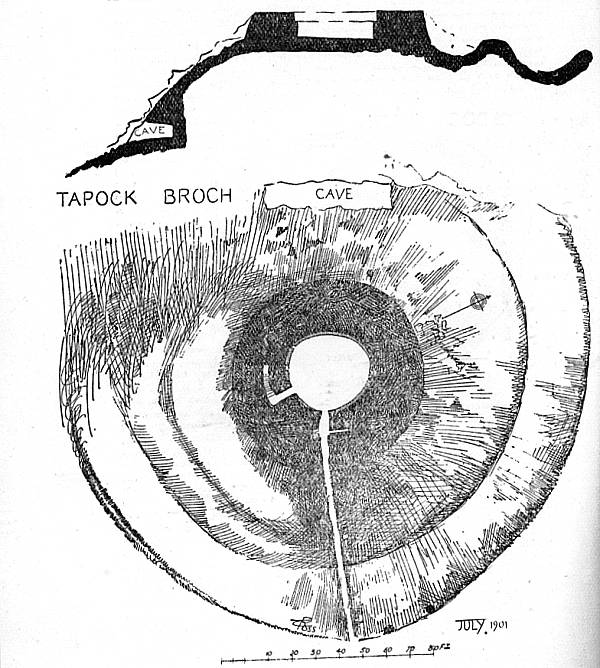
Drawing of the Broch as it appeared in 1911
At ground level there is an irregular circular chamber/courtyard measuring 10.8m by 9.8m, enclosed by a massive wall some 6.1m thick. This is made of large roughly squared blocks of stone quarried from the immediate locality, with no mortar. There is a narrow entrance passage in the south-east, with some of the lintels still in place. About half way along the passage is a check for the doorway with a bar-hole behind it to secure the door in place. To the south-west another short passage leads to a stair, which is built within the thickness of the wall. Eleven steps were reported in 1864, but some have been subsequently lost. The side walls of this stair passage slope in towards the top, suggesting that it was originally corbelled. There has been some recent collapse of the walls near the main entrance, but the site is still very impressive. A small internal chamber in the NE sector of the wall appears to be of modern origin and was not reported in either the original excavation of the survey by the RCAHMS in the 1950s. It has been suggested that this was formed by the Home Guard during the war.
The central courtyard/room had a rock floor with a large hearth in the middle. Finds included saddle and rotary querns, two hollowed pebbles, a stone cup (cruder than that found at Airth), stone balls and spindle whorls. One pottery sherd of a late Roman date is said to have been found in the 1950s. Over all this suggests an Iron Age date for the building and illustrates the kind of domestic chores that were conducted here. It is considered that such brochs had several floors providing accommodation for an extended elite family. The stone balls reflect an important status for the owner. They hark back to an earlier tradition of such symbols of power, as did three boulders bearing cup-and-ring marks of the Bronze Age. All of these finds are now in the National Museum of Scotland in Chambers Street, Edinburgh.
Two earth banks surround the broch tower, except on the west where there is a steep precipice. These are the only visible component of the extramural settlement that usually accompanies such brochs, and which contain the houses of a small settlement.
Excavations at the Fairy Knowe in Stirling district showed that it was occupied in the Roman period. It was also shown that the broch there evolved from a large round house and that it must have long been the residence of the local chief. Although the building technique may have been alien to this part of Scotland, it would seem that they were commissioned by local men. The comparative lack of Roman finds at Torwood shows that it was not occupied at the time of their occupation of Lowland Scotland. A post Roman date is suggested, which would allow the structure to dominate the old Roman road that lies only 180m to the west.
Access to the broch is by way of a footpath to the south-east. This descends the hill to join the track to Torwood Castle, about 130m south of the road though Torwood village. The track is signposted as a footpath to Denovan. The path passes through a commercial forest and anyone taking it should respect this property
Geoff Bailey (2006)
