SMR 400 / NS 8887 7336
A “Limekiln (disused)” is shown on the first edition Ordnance Survey maps at the foot of the north embankment of the Slamannan railway 190m to the north-east of Balmitchell Farm. It lies immediately to the south of the River Avon. A quarry is shown on the south side of the river 225m to the north-west and was presumable the source of the limestone.
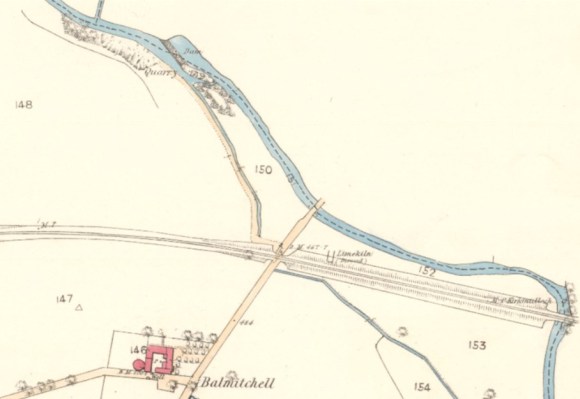
The depiction on the map suggests that the kiln operated after the opening of the Slamannan Railway in 1840, as otherwise it would have been demolished and not visible in 1860. Its south wall retained part of the railway embankment. Had the kiln been in use at the time that the railway was built it would have been easy to avoid it and so we must conclude that it was built at the same time as the Slamannan Railway and may indeed have supplied lime for the construction of its masonry structures. This would suit the form and scale of the kiln.
The Caledonian Mercury of 23 May 1799 contains an advert for the sale of Balmitchell which states that the farm was “in the vicinity of Lime”.
No trace of the kiln can be seen on the ground.
