SMR 552 / NS 832 724
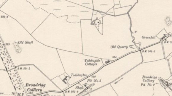
The works came into existence during the last quarter of the 19th century between the production of the first and second editions of the Ordnance Survey maps. They were constructed immediately to the north of an earlier coal pit and presumably used to bing from it to produce commons house bricks. Todbughts Farm was managed by a Mr Watt, and the brickworks were operated by Messrs J. & J. Findlay. The nature of the works meant that they only had a limited life and the site was later occupied by Sharphill Cottages
Bibliography
| Waugh, J | 1977 | Slamannan Parish through the Changing Years. “The Todsbughts Brickwork was on the property of Mr. Watt and was owned by Messrs. J. & J. Findlay. It existed during the last quarter of the 19th century.” [p.85] |
