The farm mill at Burnhouse west of Denny appears on the 1861 Ordnance Survey map and with little change on the map of 1896. The minor changes that do occur, such as the shape of the pond, suggest that the mill was used well into the twentieth century.
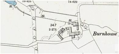
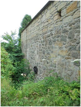
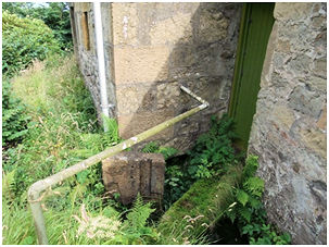
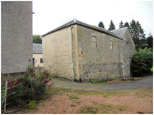
The three-storey mill building stands to the north of the farm buildings and is fed by a small stream. The wheel is now missing, but the pit and gearing can still be seen on the north side of the otherwise blank wall.
Sites and Monuments Record
| Burnhouse Farm Mill | SMR 2193 | NS 7959 8446 |
