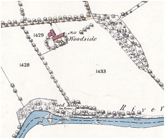
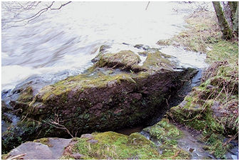
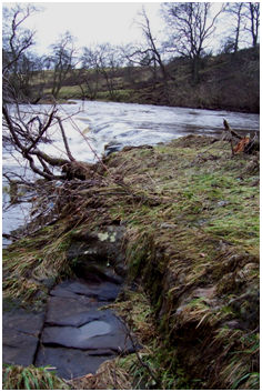
The walls of Woodside Mill on the north bank of the River Avon can still be made out amongst the trees, but the most impressive part of the complex is the rock-cut water channels.
Peter Gillies was operating this mill as a fuller in 1685 when he was arrested for his covenanting activities and subsequently executed. At that time the mill was named as “Waukmill of Woodside”. It continued to operate as a fulling mill for some 200 years, for in 1817 a sasine states :
“the milns of Woodside being 2 barley Milns and a Beating Miln“.
This also accounts for the multiple channels, at least one of which is cut for a close-fitting breastshot wheel. Robert Russell was designated “dyster at Woodside Walkmiln” in 1750, showing that dyeing was also occurring at that period. The mill is shown on Roy’s map of c1755 but the lades being rock cut on the bank of the river could not be depicted. It is also shown and named “Woodmill” on Grassom’s map of 1817. The first edition Ordnance Survey has “Wood Mill (in ruins)”. It does not appear in the Ordnance Survey name book, which suggests that this may in fact have been a functional designation.
Sites and Monuments Record
| Woodside Mill | SMR 870 | NS 9503 7342 |
