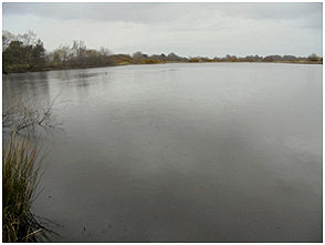
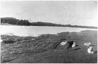
The large expanse of open water beside the Elf Hill was depicted on Pont’s map of the 1580s. The fact that it was called a “loch” along with neighbouring ones such as the Black Loch and Elrig Loch suggests that it was a natural feature. Pont calls it “Helin’s Loch” and given that the patron saint of the nearby chapel at Seabegs was St Helen we can assume that it is a reference to her.
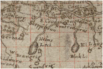
The loch also appears in the records as Bonnyside Loch, Bonnymuir Loch and High Bonnybridge Loch. To the locals in the 1920s it was simply “The Big Dam” (SMR 2244).