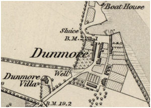
Dunmore Well
The well at Dunmore village is shown to the south of the old houses on the 1860s Ordnance Survey map (NS 89298942). The houses were subsequently demolished and replaced by a model village arranged around a square. The old well was still there when the 2nd edition map was surveyed but was now joined by a newcomer which formed a centrepiece of the public open space.
The new cast iron pump and ornamental housing were set inside a rustic shelter consisting of a slated roof with four open fretted gables supported at each corner on chunky Doric columns. The whole is set on a two tiered stone platform. The cast iron work was made in London with a square pillar at the south end housing a lion-head spout that debouches water into a low level trough. Above the chamfered plinth the pillar was shallow arched recesses with ropework hood-moulds. The upper section has columns at the corners with a denticulated entablature and a pointed top. It bears inscriptions on two sides:
“THE SCHOOL AND VILLAGE/OF / DUNMORE/ TOGETHER WITH THIS WELL/ BUILT BY/ CATHERINE NERBERT/ COUNTESS OF DUNMORE/ WERE COMPLETED/ AD 1879” and “HERE QUENCH YOUR THIRST AND MARK IN ME, AN EMBLEM OF TRUE CHARITY, WHO WHILE MY BOUNTY I RESTORE, AM NEITHER HEARD OR SEEN TO FLOW. REPAID BY FRESH SUPPLIES FROM HEAVEN, FOR EVERY CUP OF WATER GIVEN.” A plaque at the foot of the trough reads: “WM BAILY & SONS/ 71 GRACECHURCH STREET/LONDON”.
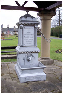
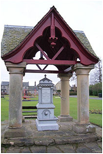
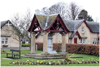
Illus: Three views of Dunmore Well in 2010.
.
(SMR 1092) – (NS 8936 8957)
Red Well
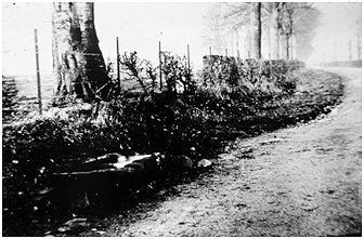
The Red Well was a well-known attraction to the south of Dunmore in the early 20th century and people walked out to it from the surrounding areas. The name came from the colour of the water which was stained with ferrous oxide as a result of mine workings. The stone trough lay at the side of the road but was removed some time ago.
(NS 8938 8864)
