The wool mill is denoted on the map of Slamannan Parish in 1806 by the symbol of a water wheel placed at the end of a long lade (NS 8217 7330 to NS 8232 7333) that is taken off the Garbethill Burn and empties into the River Avon. It is also shown on Grassom’s map of 1817 (see Rashiehill Mill) besides a steading called Gateside. Neither map names the mill itself. It was owned by a Mr Cameron who had worked in various woollen mills, including one in Dunipace. He set up his own works at Slamannan, Torphichen and Blackburn. Cameron died in 1819 and it is unlikely that the mill continued for long after that (Waugh 1977, 88).
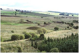
By 1860 the mill was no longer in use but two small walled enclosures, presumably associated with it, are marked as Easter Greenrig. They occupy low mounds and are too small to have been steadings. The western enclosure has two small drainage channels running towards it from the Rowantreehill Road to the north. These drains can still be seen and presumably represent roadside channels. The eastern one has a north/south path passing along its eastern side and continuing over the River Avon. It lies on the north side of the mill lade opposite to the remains of the mill. The lade is the most prominent feature of the woollen mill complex. Its southern side is formed from a large heather-covered earth mound. This becomes larger as it progresses eastward to the site of the mill. The mill is now covered with thick gorse and is cut into by large animal burrows. Some of the stone revetment on the lade is visible here, especially on the east side of the mill where the water dropped through the wheel via a sluice into the river below.
Sites and Monuments Record
| Gateside Woollen Mill | SMR 634 | NS 8232 7333 |
