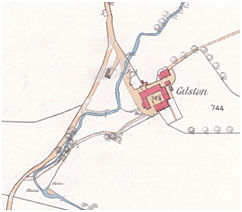
This was a small farm mill was fed by water from the Gilston Burn and was in operation in 1847 (RHP 6109 dated 1847). The sluices and lade are shown on the first edition Ordnance Survey map, but by the second edition of 1897 they had been partially removed.
Sites and Monuments Record
| Gilston Farm Mill | SMR 1063 | NS 9445 7827 |
