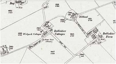
The site of a small family graveyard is mentioned in passing in the Stirling Observer of 17 December 1885 along with those at Woodend, Lochgreen and Greenhill which suggests that it was of the same 18th century date. It does not appear on the first edition Ordnance Survey map surveyed in the 1860s but that appears to have been an oversight. The grave yard is first shown on the second edition Ordnance Survey as “Private”. It was a rectangular piece of ground enclosed by a stone wall situated to the east of a row of cottages and close to Ballinkier Well. The site is now in the rear gardens of 10 Ash Place.
Ballinkier Graveyard SMR 1329 NS 7826 7889
