
SMR 2364 / NS 9113 7966
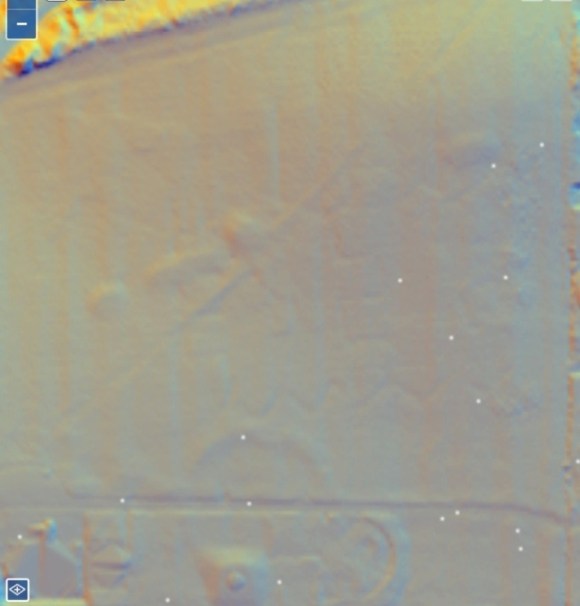
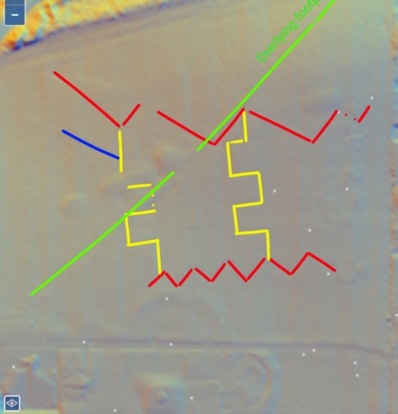
Using Lidar data from the National Library of Scotland in August 2026, Steven Twigg recognised several features in the upper part of Laurieston Park as elements of a defensive system belonging to the 20th century.
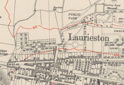
The 3.8 acres of land for the High Park were only purchased by the Laurieston Village Committee in the mid 1930s for an extension to the existing park in anticipation of new house building in the area and this was laid out and equipped before being handed over to the Eastern District Council just before the start of the Second World War. The new section was separated from the old by the Swinedyke Plantation and was more formally laid out. The west side of the park contained an avenue of trees lining the drive to McKillop’s Buildings at Thornbridge and so on to Grangemouth. This was the main artery for those tenements.
House building was held up during the Second World War and in 1942 the 36th Independent Infantry Brigade camped in the Low Park for several months. They were training in house-to-house fighting techniques using the now empty houses at Thornbridge. Local farmers were refused permission to graze their cattle in the Park, but were granted permission to cut the grass and take it away. Six allotments were formed within the Park.
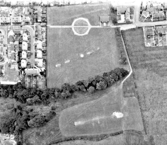
Twigg’s analysis of the Lidar data revealed a zig-zag firing trench, two communication trenches and a support trench. The zig-zag trench is the most southerly element and is located just to the north of the west/east path which connects Park Avenue with Zetland Drive. It lies at a slight angle to that path, reflecting the natural contours. Indeed, it can be made out on an aerial photograph of 1968 where it can be seen to be parallel to the playground equipment lower down the slope to the north, which in turn reflects the strip of woodland on the escarpment even further north. The visible extent of the zig-zag trench is around 68m, running east-west from NS 91226 79673 (annotated in red on illus 4). Each return section is about 8.5m, (28ft). There are two faint communication trenches (shown in yellow) running north/south c37m, with the returns c9m. The support trench is the most northerly (also in red) with the visible extent running east/west for c93m from NS 91225 79729. The returns are variable with the longest being c18m, and the shortest 15m.
NS 91131 79668
BNG Eastings, Northings: 291131, 679668
Latitude, Longitude: 55.997567, -3.747111
Several defensive posts were established along the line of the Antonine Wall by the Home Guard in the summer of 1942 in order to provide a stop-line preventing German paratroops from making their way north from drop zones in the Braes (Bailey 2021, 161-163). The south-facing posture of the Laurieston Park features suggests that they were part of this scheme. The support trench probably gave access from Swinedyke Plantation, providing cover for troops arriving from the Grangemouth direction. The park was the only open land along this section of the Antonine Wall and elsewhere the Home Guard would have employed guerrilla tactics amongst the houses.
A zig-zag trench used by the Home Guard in conjunction with the Polish Army can still be seen in the grounds of South Bantaskine Park.
Bibliography
| Bailey, G.B. | 2008 | Hard as Nails: the Home Guard in Falkirk District. |
| Bailey, G.B. | 2021 | The Antonine Wall in Falkirk District. |
| FLHS Website | 2025 | Laurieston Park |

