
SMR 787 / NS 993 813
Introduction
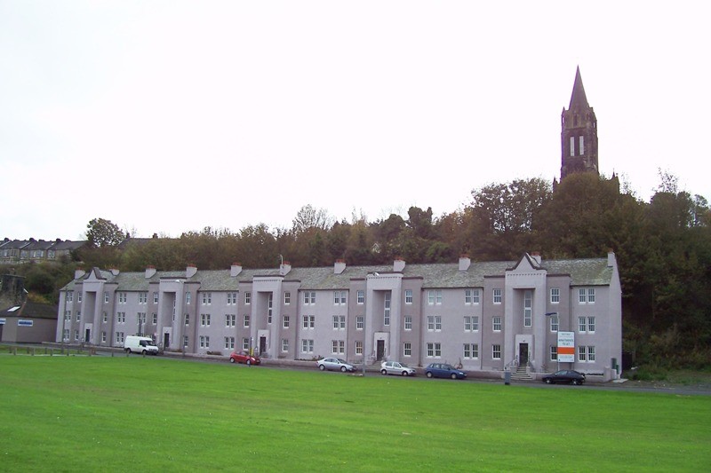
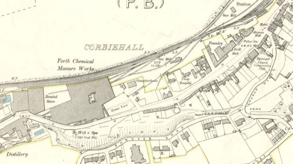
Entering the town of Bo’ness from the west the traveller approaches along the old turnpike road that follows the foot of the escarpment that until the 18th century formed the coastline. Entering the suburb of Corbiehall the first building on the right is now a large tenement known as the Queen Mary Buildings. Most people note this large 1930s building with its art deco finishes resembling the ocean liner from which its name derives. Few strangers to the area become aware that on the opposite side of the road is an old burial ground. The casual passerby only sees yet another grassy roadside verge.
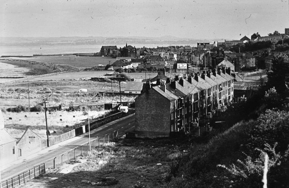
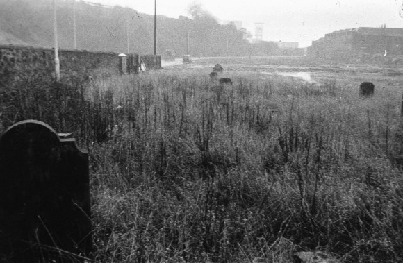
Rubbish had been dumped everywhere, the vegetation had run rampant, the boundary walls were unsafe, fences had been vandalised and the surrounding industrial sites lay derelict. The area was an unsightly mess and a health hazard to the community. No one ever visited the burial ground, which had long ceased to function. Now we have a pleasant green meadow giving access across the railway track to the nature reserve on the banks of the Forth Estuary. And the tombstones? Well they lie flat, just below the level of the grass in the south- east corner of the field. Some 34 are still exposed; the remainder buried around them.
Indeed, the existence of a graveyard on the north side of the A904 Corbiehall Road is today just a faint memory to the older inhabitants. Yet the burial ground, replete with head stones, was there for all to see until 1978. In that year, after almost a century of neglect, it was levelled and landscaped by Falkirk District Council. At the time of the decision to do so the site constantly flooded and rainwater stood for long periods of time.
History
So neglected had the graveyard become that its origins have been shrouded in mystery. Writing in 1913 the Bo’ness historian Thomas Salmon was given to “understand the churchyard on the shore at Corbiehall was necessitated because of the havoc which this outbreak (of cholera in 1851) caused among the inhabitants” (Salmon 1913, 420). Even today there is a local tradition that the graveyard was for sailors connected with the port of Bo’ness. It is said that the sailors wanted to be buried within spitting distance of the coast and that the waterlogged condition of the site reminded them of burial at sea.
Alas, the truth is likely to be less dramatic or prosaic then either of these accounts. The burial ground to the south of the parish church in Bo’ness had been in use since the 17th century and was severely overcrowded. It lay on steeply sloping ground on either side of Church Wynd. Not only did this gradient cause difficulties in digging the graves and performing the burial service, it also allowed noxious substances to ooze down the hillside.
By the time of the accession of Victoria to the British throne the citizens of Bo’ness were searching for an alternative burial plot. There was no suitable ground in the immediate vicinity of the parish church. In any case, there were now several other denominations in the town all needing the same requirement. The established church still saw itself in the lead role and as the owner of the existing burial ground it was undoubtedly the chief promoter of a new graveyard. The minister’s glebe stretched along the shore from Capies Point in the west to the harbour facilities in the east. Between Capies Point and the Corbiehall Saltworks some of the foreshore had been reclaimed. Ashes from the saltworks had been dumped there over the centuries and latterly pit waste from the Kinneil Colliery had added significantly to them. Then from 1840 onwards the Kinneil Ironworks radically remoulded the coastline and the arrival of the railway in 1850 isolated huge tracts of land from the sea. The land between Corbiehall Road and the railway was now relatively dry (it only became waterlogged as a result of action in the 20th century), but being reclaimed with waste was considered to be of little value. Sometime around 1845 the minister allowed one of the old enclosures here to be adopted as a new cemetery without payment of any kind (SRO CH2/540/30 – 12).
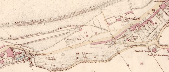
The enclosure lay immediately to the west of the saltworks and had been laid out around 1800 on the ashes from these works. Its northern boundary at the time lay on the tidal limit of the gently shelving coast. Consequently the enclosure was an odd shape, being wider at the east end where more land had been reclaimed. The Cleuch turnpike had been driven through the area and formed the southern limit of the new plot. The road was bounded on the north by a waggonway taking coal from Kinneil Estate to the harbour at Bo’ness (via Waggon Road). It appears that a branch of this waggonway led into the saltworks to supply it with the great quantities of panwood or dross that it consumed. This branch line passed through the south east corner of the enclosure and gave rise to the exclusion of this part resulting in the irregular shaped cemetery boundaries seen on the plan.
Description
A boundary wall, some 2m tall, was soon erected around the burial ground. The north wall was 59m long and the average north/south dimension was 42.5m. The irregular shape thus enclosed measured 0.29 hectares (0.71 acre). The south-east corner of the boundary wall was curved to reduce the chances of damage by horse drawn vehicles heading for the main entrance in the centre of the east wall. The entrance faced the town and avoided any conflict with the waggonway. It was flanked by substantial gate piers made of ashlar blocks divided by V-channel joints. A tree-lined path led from the gate to the west end of the graveyard. This is clearly depicted on the first edition Ordnance Survey map and can be seen reflected in the plan by the absence of gravestones along its track. A small building in the north-east corner presumably functioned as the sexton’s shed.
The earliest burial recorded on a gravestone appears to be that of Alexander Nimmo in 1848, followed by his mother in 1852 (Stone Number 7). There is then a gap of seven years (No. 75) and from then on burials increased steadily in number. In 1866 the graveyard was referred to in the Penny Post as the new “cemetery”. The use of the word cemetery shows that the graveyard was ecumenical. Burials start to tail off after 1880 and continued in existing lairs into the 1890s. By then the more salubrious cemetery behind the new parish church, off Dundas Street, was operating well. It was operated by the Council and had opened in 1881. In the 19th century a large chemical works (latterly Fison’s) grew up to the west of the cemetery and a slaughterhouse was established to the north east. Little surprise then that few people visited it!
| DATE | No. of NEW STONES |
|---|---|
| 1800-1849 | 1 |
| 1850-1859 | 1 |
| 1860-1869 | 18 |
| DATE | No. of NEW STONES |
|---|---|
| 1870-1879 | 16 |
| 1880-1889 | 2 |
| 1890 – | 1 |
The apparent gap in the recorded tombstone dates between 1848 and 1859 is interesting, as this would include the period surrounding the cholera epidemic and its aftermath. It would have been some time after the last cholera death that the ground in the area would have been broken again. Given the priorities it is not surprising that few stones would have been erected then. The site was quite suitable for the disposal of the cholera victims, as the alkaline ashes would act as a disinfectant.
The distribution of gravestones in the cemetery was relatively even. Apart from the void left by the axial path there was also a notable absence along the northern wall. This may have been due to it being nearest to the sea, or due to the presence there of the cholera victims, buried in haste. The fact that this part of the graveyard lies furthest from any habitation and would have contained the greatest depth of ashes favours the second explanation. The locations of burials throughout the three decades after 1860 are evenly distributed, as one might expect if all the lairs had been sold at one time. Clearly the whole yard was laid out in a single exercise and was not subjected to subsequent growth or expansion.
The east wall, being the nearest to the town, attracted the attention of the monumental mason and contained a number of wall mounted monuments. By contrast the western boundary was latterly a fence made of railway sleepers. It is not known whether there was ever a stone-built wall here. It is possible that such a wall, poorly founded, had been allowed to fall into decay and had been replaced. Alternatively, it may have been a wooden fence from the start in order to allow for future expansion in that direction.
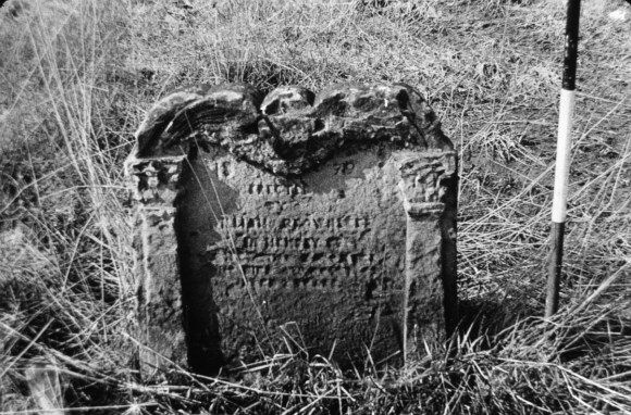
There are a number of stones that were evidently brought from the old parish churchyard for re-use. No. 42, for example, has the date 1742 carved on its top surface, but the facial inscription was only added in 1879. Similarly, No. 45 bears the date 1835 and this was cemented over when a new dedication was placed on the other side by people with no obvious family connection. Stylistically, the carved decoration on Nos. 36, 42, 52, 70 and 72 shows that the stones all originally belonged to the latter half of the 18th century.
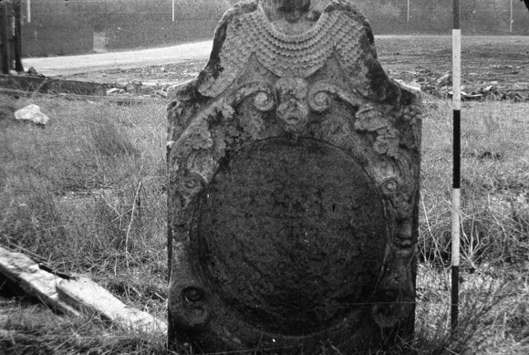
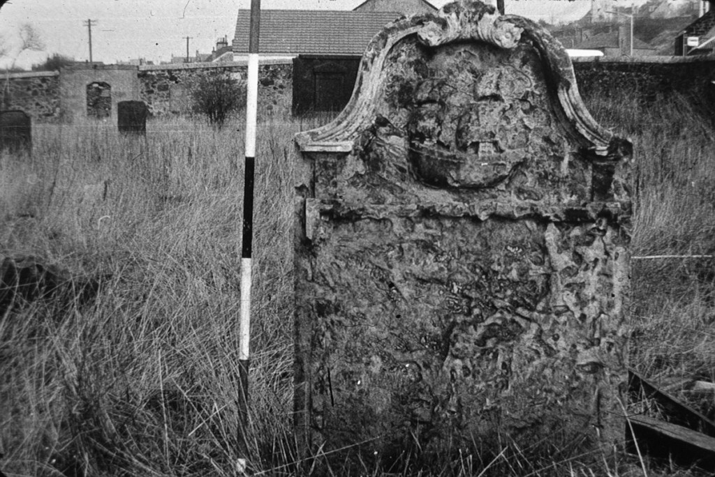
No. 79 is of fireclay, but the remainder of the memorials are sandstone. The older and more elaborate gravestones are executed in a fine-grained sandstone, which is hard wearing. This may have been available at one of the many quarries in the Bo’ness area, or it may have come been brought down the river from the well-known beds at Dunmore/Longannet. Later stones are from bedded sandstones that have a tendency to laminate and were imported.

