SMR 290 / NS 9969 8148
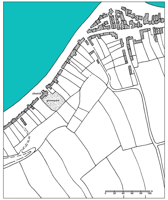
The rapid growth of Bo’ness on the south shore of the Forth Estuary from the late 16th century to the late 18th century was unleashed by the unparalleled upturn in trade and commerce of that period. In the 16th century the small village on the hill at Kinneil was the main community within the parish of that name, with only a small huddle of fishermen’s houses along the coast at the Ness. As shipping became more profitable, tradesmen moved down to the anchorage and set up businesses there. The main export was the locally mined coal. Waste coal was used to produce salt, which also found a ready market. The new settlement spread along the south side of a coastal road overlooking the estuary, with a cluster of buildings to the north of the road serving the harbour. The architectural style of these buildings was typical of the ports along the Forth coast, such as may still be seen at places such as Culross, Dysart, Crail, Prestonpans and Airth. By 1636 the inhabitants of Bo’ness had become so numerous that they established a congregation separate from that at Kinneil and two years later the combined wealth of the merchants and seamen enabled them to construct a church (SMR 283) near the west end of the town. This was a simple single storey building with an aisle to the south for the sailors and the minister at Kinneil did duty at both churches.
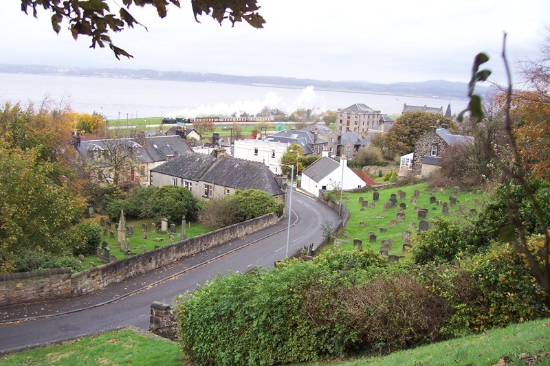
The site for the new church was paid for by the inhabitants of the port and from the beginning it included a large burial ground to the south or sunny side. The church faced out across the Forth across a narrow forecourt. The land had belonged to the town’s patron, the Duke of Hamilton, who promoted the economic development of the settlement as a means of increasing his own revenues. The money came from public subscription, largely through the local Sea Box – a friendly society for the sailors. As a consequence the inhabitants of the town had a greater say over the management of the church property than was normal at that time and appointed “representatives” to voice their opinions. The shape of the church lands was determined by the existing feus and the local topography. From the coastal road the west and east boundaries extended straight back some 52m up a gentle slope and stopped at a change in the gradient where a pre-existing property boundary lay. This south boundary was on the same line as the rear boundary of the properties on either side.