
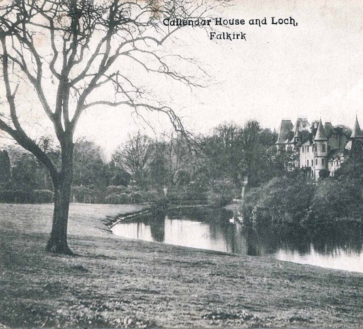
SMR 1405b / NS 901 792
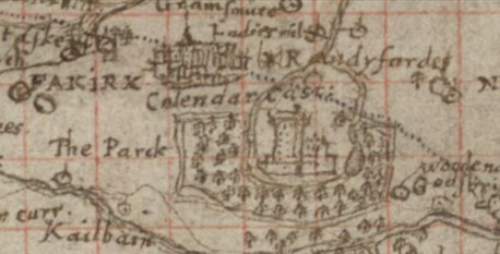
To the east of Callendar House Pont’s map of c1590 shows a loch. The depiction of the water courses around the House is unclear. It certainly shows a burn leading from the west end of the loch running south passed the House and then turning north to run east of Falkirk. This is the East Burn of Falkirk. However, it also shows a stream heading north-east and then joining the East Burn near Ladies Mill – the Gallow Syke. Having a stream issuing from either end of the loch would be a little odd – although that is precisely what happens today due to the cutting of an artificial channel at the east end of the loch. Close examination of the map suggests a solution. It actually shows two lochs, the western one being the large one known today as Callendar Loch; the other, smaller loch, would have been Lanton Loch which is mentioned in 1723 by Johnston of Kirkland: “East from the house of Callander within the parks is a pleasant little loch called Lantonloch there is another near the house called the Callander Loch.” Perch, pike and eels could be caught (Meikle 1879, 89).
Both the Lanton and Callendar Lochs were comparatively small and that may explain why Roy’s surveyors overlooked them in 1755. This was also a period when drainage was being introduced in Scotland on a large scale. In the case of Callendar Loch it looks like the water was moved a little to the west to fill large fish ponds located immediately to the south of the House. These were quite a conspicuous feature and Sibbald mentions then in 1707. They were probably created for the first earl of Callendar in the 1670s reflecting his taste for Dutch landscaping which he had acquired during is time on the Continent. The ponds had been filled in by 1781 and a lawn/bowling green created in their place as was required by the changing aspirations of the period. An estate plan drawn up for the sale of Callendar House in 1781 shows that Callendar Loch was a mere swelling at the eastern end of the East Burn. Lanton Loch was marked “Flooded Grass.” It was located immediately to the north of the esker in the area now occupied by the offices of the Child Support Agency (and previously by the sports fields of the College of Education).
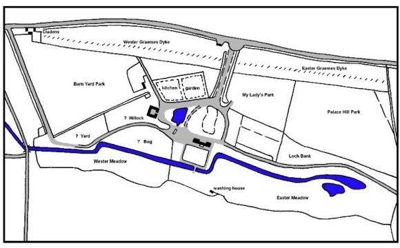
Meadows ran along the south bank of the East Burn and around the loch. On the north side was a driveway called Lochbank. In the years after the estate was forfeited due to the owner’s participation on the Jacobite side at the Battle of Sheriffmuir in 1715, the drive had been used as a short-cut by the public. Upon purchasing the estate in 1783 William Forbes and his representatives excluded them.
“I am keeping many people from making, as they have done for some time, thorough fares of the Lochbank and pleasure grounds They were grown too common The Lochbank is the admired grass walk with large trees on each side, of about 3/4 of a mile long leading from Cal: house to Sir A Livingstone’s”
wrote David Forbes to his brother (Forbes Papers 172/17, 3 April 1784).
William Forbes employed a landscape architect from Southwark in London called William Driver to ensure that the parkland was properly designed. He drew up plans that included enlarging the pond at the source of the East Burn to create a much larger picturesque loch. The course of the stream westward was also to be canalised and the water in it maintained at a high level by means of a curving cascade which could be viewed from an adjacent ornamental bridge.
“About 100 workmen, gardeners and labourers, are employed within the park or policy, improving and ornamenting the grounds, such as draining some marshy land, making fine walks, avenues, lawns, greens, planting the finest trees and shrubs that can be got, and twenty et ceteras.”
Whilst digging the swampy area at the source of the East Burn the workmen encountered rich black layers of silt from the bottom of the old loch.
“Chas Clark’s men are still working in the lock in the meadow – you may remember I said it would be a tedious operation but it is producing excellent manure, it is allowed to be better than any we have yet dug anywhere. After taking off the surface, we come into a rich black mud, which is almost inexhaustible; they are making it up in composts with lime which Burnside burns. I think it may save us making any other compost this year” (282/9, 17 Sep 1787). “The mud of the loch is not mixed with lime immediately when it comes out, for then it is quite thin, it is wheeled out and lyes till it is dry.” (282/10, 27 Sep 1787).
The dip in the esker between the two lochs was enlarged to improve the Easter Avenue and extend it eastward beyond the Lochbank.
“Mcgregor with his men on the Roman wall are come very near that place where we ride thro’ to the loch in the Howletfauld, I mean near to the Cooks tree I do not think he has come on slowly considering the stones and tree roots he has had to encounter” (282/9, 17 Sep 1787).
From there the avenue continued north-eastward in the valley of the Gallow Syke and was planted with lime trees. The Lanton Loch survived as a small pond to the east of this drive, but before long it was completely drained.
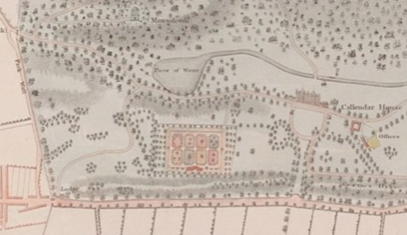
Despite all of the disturbances to the loch it was discovered that the leaches, mentioned as early as 1723, had survived and were thriving. In 1811 specimens were taken through to Edinburgh and found to be ideal for medicinal purposes with the result that for a short period they were commercially harvested (Forbes Papers 988/1 & 2). The new configuration of water also made the loch suitable for curling matches in the winter and for several years the Falkirk curlers were given free access for that purpose, until purpose-made ponds at the old washing green became available (Meikle 1879, 89). The first recorded curling match was between Grahamston Curling Club and Falkirk Curling Club in 1837 (Falkirk Archives a746.1). Thereafter it seems to have become an annual match, lasting around five hours.
Around 1830 the ornamental canal was extended to the west by the moving the weir to the west end of the park. In front of the weir a small loch was created. The canal and the loch are shown holding water on the 1860 Ordnance Survey map, but by 1870 they had been drained and their banks grassed (Meikle 1879, 89) and have remained so to the present day. It was probably also in the 1830s that Callendar Loch was enlarged by extending it to the west. The extension contained four islands, reflecting the more naturalistic landscaping movement.
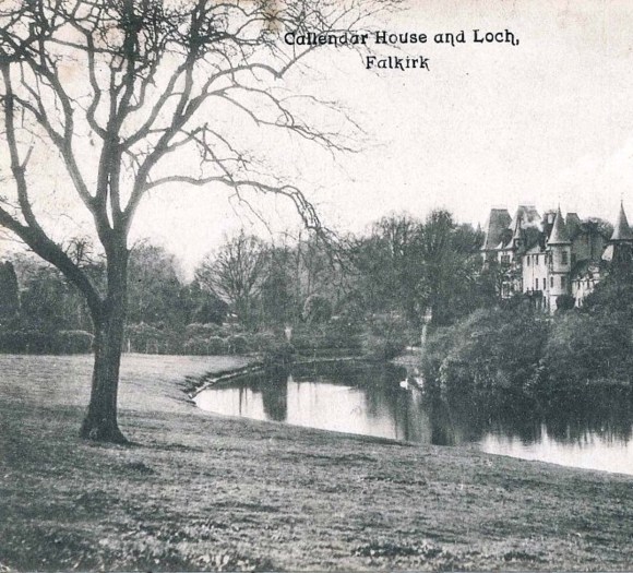
After the extremely brief visit of Queen Victoria in 1842 the Royal couple were headed from Linlithgow and were conveyed by the Lochbank Avenue to the Laurieston Lodge. Prince Albert was particularly taken by the line of lime and elm trees beside the loch.
After 1963 Falkirk Council opened up the park to the public. Recreational facilities were developed to increase the park’s use. In the 1970s the Loch was extended for use as a boating pond, complete with jetty and booking office.
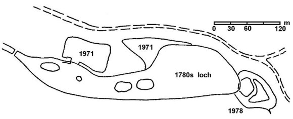
In 1971 an unsightly square protrusion was appended on the north side at the west end of the loch for boating purposes, separated from the original loch by two tongues of earth. A booking office was erected at the end of the west jetty. Over the decades since then this part of the loch inevitably silted up and it is here that ice first forms in the winter months, tempting pupils from the nearby high school to venture out. It was probably also in 1971 that a spur of marshy ground to the east of this was incorporated into the open water, altering the former naturalistic curves. By 1978, when the extension on the east end of the loch was made, designs had improved and large islands were incorporated to encourage wildlife. A new overflow now led excess water away to the north-east, presumably because the old pipe along the line of the East Burn was having trouble coping in times of excessive rainfall.
Bibliography
| Bailey, G. B. | 2000 | Here is the shade of a well peopled wood: Callendar Park. |
| MacFarlane, W. | 1906 | Geographical Collections Volume 1; Johnston of Kirkland. East from the house of Callander within the parks is a pleasant little loch called Lantonloch there is another near the house called the Callander Loch. In both thir lochs are loch leaches caught. |
| Meikle, J. | 1880 | Callendar House: its place in Scottish history (Falkirk Herald). |
| Sibbald, R | 1707 | History and Description of Stirlingshire, Ancient and Modern. |

