
SMR 1781
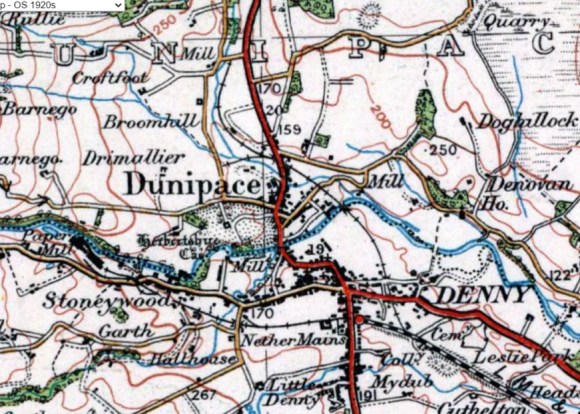
In 1859 the Scottish Central Railway constructed a single track branch northwards from the Denny Railway at East Boreland to the Quarter Pit at Ingliston, a distance of 2.5km. It opened in January 1860 and was initially simply called the “Denny Branch Extension” before becoming known as the “Ingliston Branch Railway,” with the junction at East Boreland called the “Ingliston Junction.” At the same time a short-lived side branch shot off from Rosebank to ironstone pits at Risk and Drimallier. By 1913 it had been heavily truncated to terminate at a gravel pit at Tygotshaugh. At the same time, as the Quarter Pit grew in size, the main branch line was extended north beyond the goods yard at Ingliston and the road to Northfield. It ran along the west side of the Denny Road and tramways sprung off up the hill to the east serving Quarter Colliery Pit No 1. By 1920 that pit had closed and the railway contracted back to Ingliston. Further reduction occurred in 1955 when it ended just to the east of the bridge at Rosebank on the Stirling Road.
Almost at its junction with the Denny line the new branch line was crossed by a pre-existing public footpath that followed the old stream course there. This was a perennial problem for the train operators and was eventually closed.
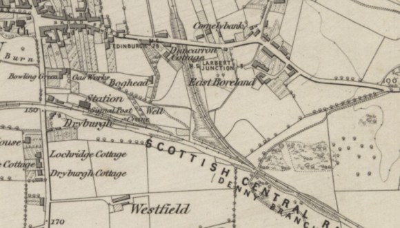
Almost at its junction with the Denny line the new branch line was crossed by a pre-existing public footpath that followed the old stream course there. This was a perennial problem for the train operators and was eventually closed.
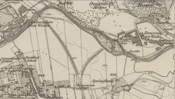
From the beginning an embankment was built north-eastwards at Springfield, a little north of the Comelybank Foundry, to carry another branch over the River Carron to the huge works at Denovan Printfield, but the collapse of that industry meant that it was never completed. Much later, probably in the early 1930s, a side branch was taken off at this old junction to the south-east to provide coal for the new gas works belonging to Denny Town Council. Coke and tar were exported from the works. This required a level crossing to carry it over Herbertshire Street. The abandoned embankment to Denovan, known as “the Rosy Banking,” was utilised by the Home Guard in the Second World War as part of its perimeter defences. Adjacent to the gas works was a slaughter house and for a short time in the early 1950s livestock was unloaded from this branch.
| NAME OF WORKS | APPROX. DATES | DISTANCE FROM INGLISTON JUNCTION (km) |
|---|---|---|
| Quarter Pit | 1860-1890 | 2.51 |
| Quarter Pit No 1 | 2.82 | |
| Duncarron Iron Works | 1902-1978 | 0.10 |
| Herbertshire Print Works | 1884-1920 | |
| Anchor Paper Mill | 1892-1978 | 1.11 |
| Vale Paper Mill | 1.07 | |
| Anchor Brickworks | 1898-1932 | 1.6 |
| Risk Pit | 1860-1885 | 2.45 |
| Drimullier Pit | 1860-1885 | 2.3 |
| Denny Gas Works | 1930-1960 | 0.77 |
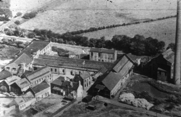
The Vale Paper Company was inaugurated in February 1894 by three brothers, Alexander, James and Robert Luke, who purchased the old Herbertshire Printworks. That works had been closed for decades and the buildings were pretty ruinous, though there was a char mill and a lithographic print works on the site – by then known as Carronvale. The sale notice emphasised that :
“The Caledonian Railway intersects the Lands on a level most convenient for a Siding, and the Denny Station is in the immediate neighbourhood.”
(Dundee Advertiser 27 March 1883, 1).
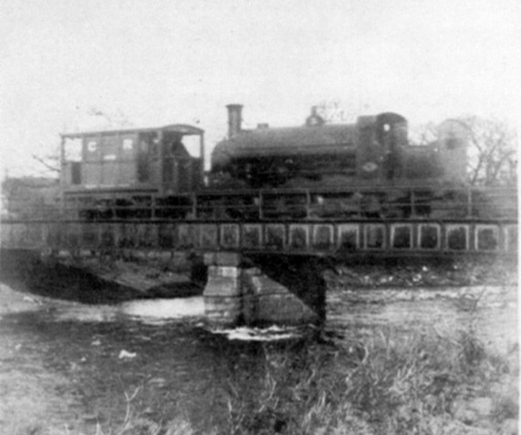
The northern part of the Ingliston Branch as far south at Stirling Street closed on 1 April 1955 and shortly afterwards the M80 motorway was constructed with a temporary roundabout occupying the site if the former Ingliston Yard. This yard had latterly been used occasionally to deliver material for the local farmers. The remainder of the Branch closed on 31 March 1965.
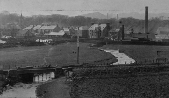
1.03km from the Ingliston Junction the line had to cross the River Carron by a bridge which became known as the Vale Bridge after the nearby paper works. 1.29km from the Ingliston Junction it also crossed the Anchor or Avon Burn.
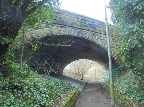
1.61km from the Junction was the bridge at Rosebank (NS 8077 8367) carrying the main road north from Denny to Stirling. It was built on the skew and required an approach embankment on the south side.
Today
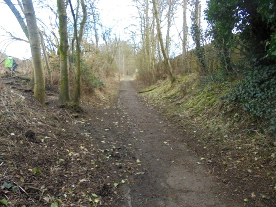
Falkirk Council acquired the old railway line in the early 1970s and as part of its Denny Project provided good quality asphalt surface from the Ingliston Junction to the bridge at Rosebank, a distance of 1.61km. From there a hardcore path can be followed south-westwards to the Avon Burn, a further 185m.
Beyond the bridge the path forms a prominent terrace with the town on the west and the Winchester Industrial Estate on the east. It gently descends to the River Carron where until recently the flatbed steel bridge was supported on the original stone piers. Sadly, the bridge was replaced in 2018 and the new single low-arched bridge did not require any central support and so the piers were removed.
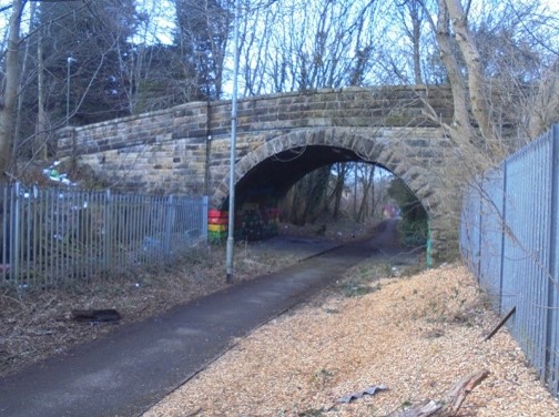
The area surrounding the Ingliston Junction is now a broad grassed park providing leisure use for the general public. After a short distance the walker now has to leave the railway cutting and cross the Broad Street at a level, noting that the bridge parapets are still in place. A little further on is the remaining stone arched bridge carrying Herbertshire Street over the railway.
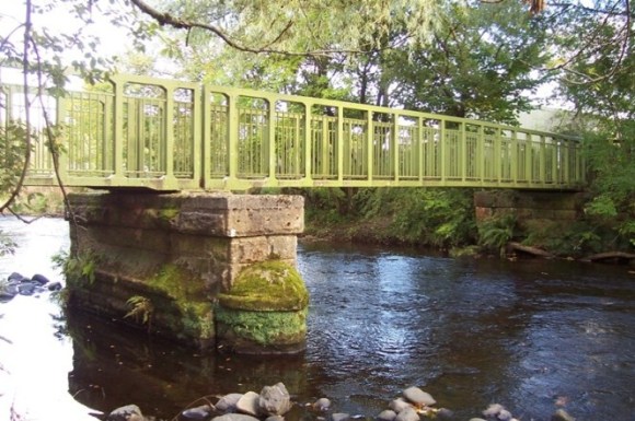
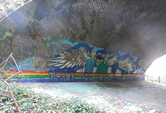
Just to the north of the river, on the west side of the railway, were the Anchor and Vale paper mills (now replaced by the ubiquitous housing estates). To the east the fields are still open and much used by dog walkers. Further on, the road bridge at Rosebank is an excellent example of a skew bridge – crossing the railway at an angle. The bricks of the underside of the arch provide an interesting pattern of layering and also now sport an artwork acting as a reminder of the Covid epidemic of 2021.
Bibliography
| Gillies, A. | 2018 | Denny and Dunipace in Words and Pictures. |
| Railscot | Website https://www.railscot.co.uk/ |

