
SMR 247 / NS 9830 7719
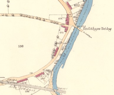
The road from Linlithgow Bridge to Causewayend, or the Muir Road as it was referred to in 1723, was one of the main routes to Glasgow and the west. A public house was established at the west end of the bridge in the early 18th century (SMR 246) and before long several dwellings were built along the road to the south in the barony of Almond. All of these were placed up against the road and had garden plots to their rears. The first two blocks on the west side of the road (blocks A and B), close to the junction with the highway to Whitecross and Falkirk, were of two storeys, whilst those on the south side of the road as it turned to the west were single storey. All were of the local sandstone rubble with backset margins and possessed pantile roofs.
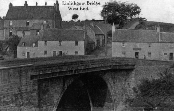
The public house was the first to be built and is shown on Roy’s map of 1755. It stood on the north side of the Whitecross road. A similar building, Block A, was erected on the southern corner around 1760 and, despite containing two dwellings, was built to mirror the main building of the inn complex. The pair thus framed the road junction and acted as a fitting entrance into Stirlingshire.
Smaller houses were built on the south side of the Whitecross Road, going up the hill, and are depicted on Grassom’s map of 1818. A one and a half-storey house with dormer windows was added to the south gable of Block A around 1825.
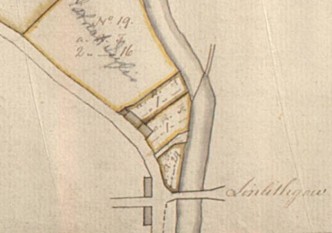
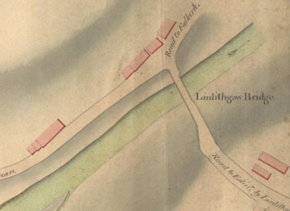
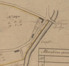
Block B, Waterside Cottage, does not appear on Roy’s map but is on that of Lauder in 1796 and a date of c1770 would be appropriate. Stevenson’s plan of 1816 shows it with the two southerly extensions already in place.
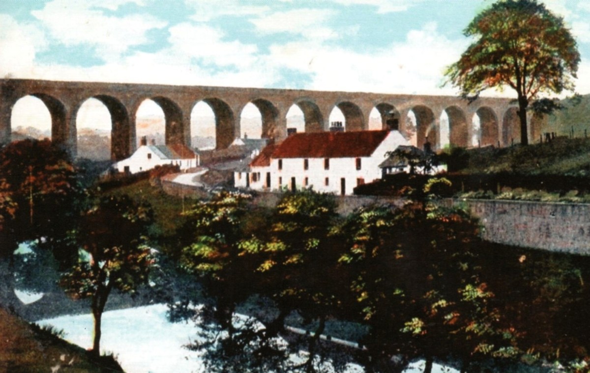
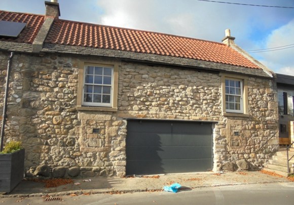
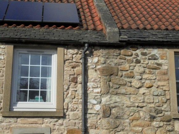
The stonework on the road façade is now laid bare and shows the larger whinstone boulders in the base course. The sandstone is much worn and only traces of the original backset margins survive. The stonework suggests that the northern cottage was built first as a single storey building. The southern one was then added and at some stage the original one was raised by a storey and eventually so too was the second. By the early 19th century the block consisted of two two-storey buildings each with a central doorway and a small window to either side with two larger windows on the upper floor. This symmetry can be seen on the coloured photo. The two single-storey extensions were set back a little from the façade, and in the mid 19th century a northern extension was built at a slightly higher level requiring access steps.graph of c1910 above in which they appeared lime-washed with ridged pantile roofs.
The two single-storey extensions were set back a little from the façade, and in the mid 19th century a northern extension was built at a slightly higher level requiring access steps.
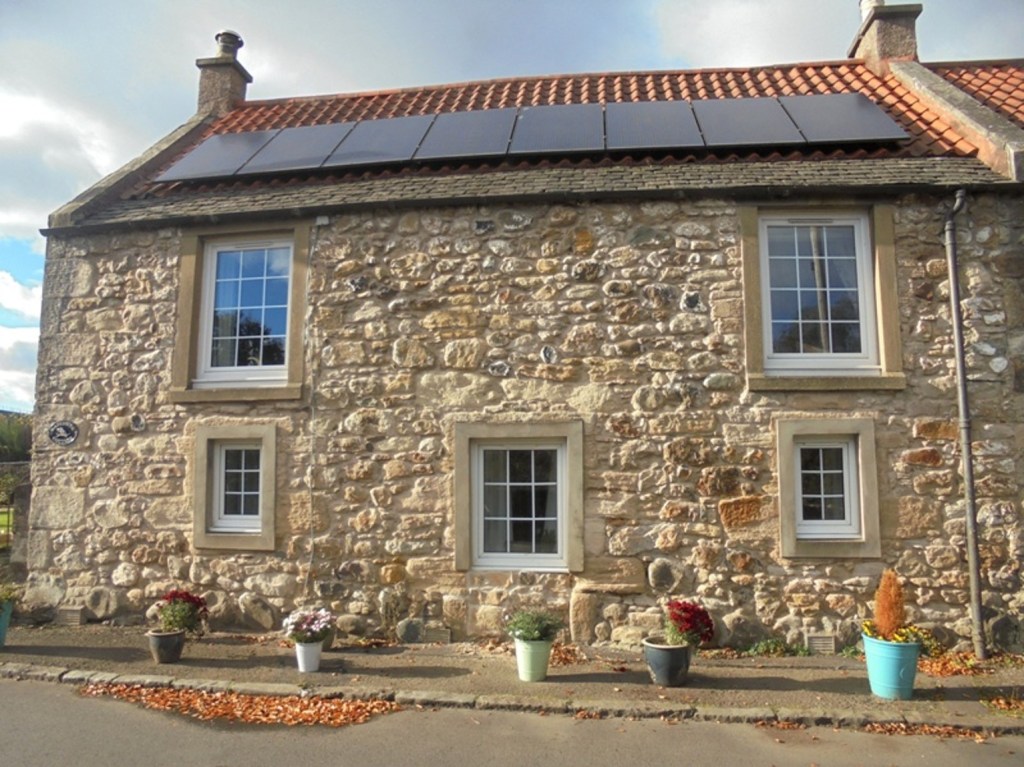
At the beginning of the 21st century the block was refurbished. Vehicular access to an internal garage was inserted into the northern block, replacing the original doorway. The doorway of the southern block was converted into a window so that access is now restricted to the northern end of the building and to the rear. The window margins were given crisp new cement borders, masking the originals. New red pantiles give a strange regularity to the roof, with an unusually broad basal band of slate, partly interrupted by solar panels. Despite these alterations the 18th century dwellings can still be made out.
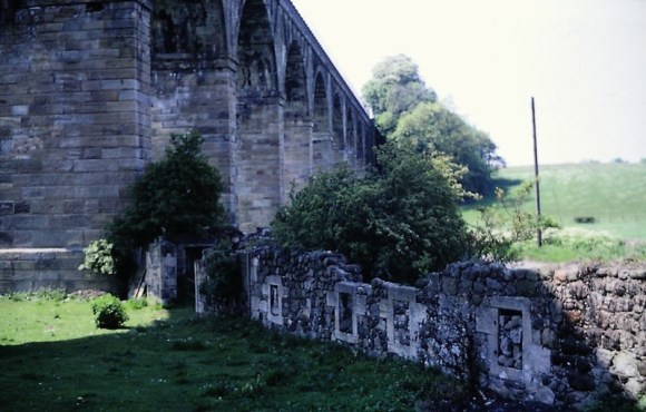
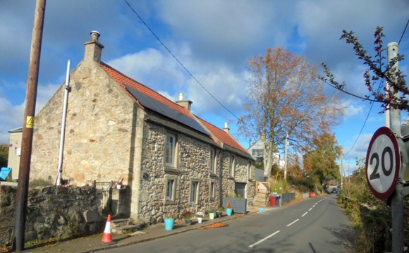
Block C appears on the 1796 plan but has been so radically altered that little of the 18th century building survives. Block D is now in ruins. It is not of the 1796 plan but its relationship with the Avon Viaduct shows that it was built earlier than 1842. It too is in ruins and these are slowly diminishing in size. The western gable contains windows with backset margins whereas the bulk of the windows on the south front have machine-dressed plain margins, indicating that it began as a small cothouse and was extended over the years.
NEWSPAPERS
- The Scotsman, 19 May 1883, 3: For sale, there will be exposed to sale by public roup, within the Star and Garter Hotel, Linlithgow… All and Whole that PART of the LANDS of ALMOND, near Linlithgow Bridge, in the parish of Muiravonside and County of Stirling, on the south side of the road leading from Linlithgow Bridge to Manuel, containing about a rood of land, together with the whole Dwelling-houses and other Buildings erected thereon, all as at present or lately tenanted by John Taylor, Anthony Hart, and John Baxter.
- Rental £12 4s; feu duty £1 1s…
- Aberdeen Evening Gazette, 1 October 1885, 2: About six o’clock on Saturday mornning, one of the tenants of the cottages situated immediately below the viaduct on the Stirlingshire side of the Avon, happening to enter his garden, found the body of a man with the head embedded in the earth to the depth of six inches. In the course of the day the body was identified as that of a married man named James Gemmell, 45 years of age, a ploughman in the employment of Mr Reid, Haining Valley. Gemmell had been at Stirling feeing market on Friday, and returned by train to Manuel railway station about none o-clock at night, somewhat the worse for drink. Instead of returning west towards his home, he had gone eastwards, and on reaching the viaduct must have gone over the stone wall, and fallen head foremost into the gardens, a height of about 80 feet.

